You cannot view your vehicles in Street View as these are made up of Google images, but you can, as examples, view the exact location a vehicle has passed or stopped, follow its route, or see where it was speeding.
To enable Street View, either:
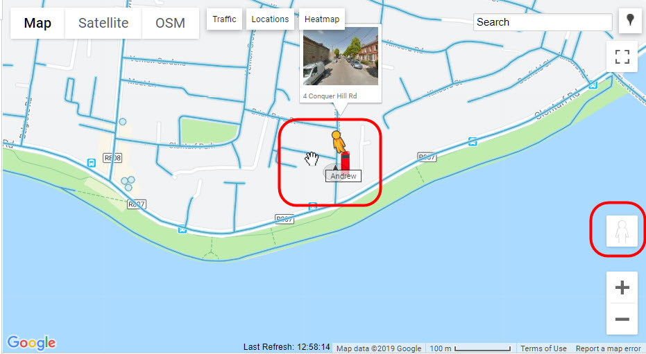
Drag Pegman and drop onto the required blue highlighted road.
Note: if a road is not highlighted in blue, then there are no Street View images available.
Or
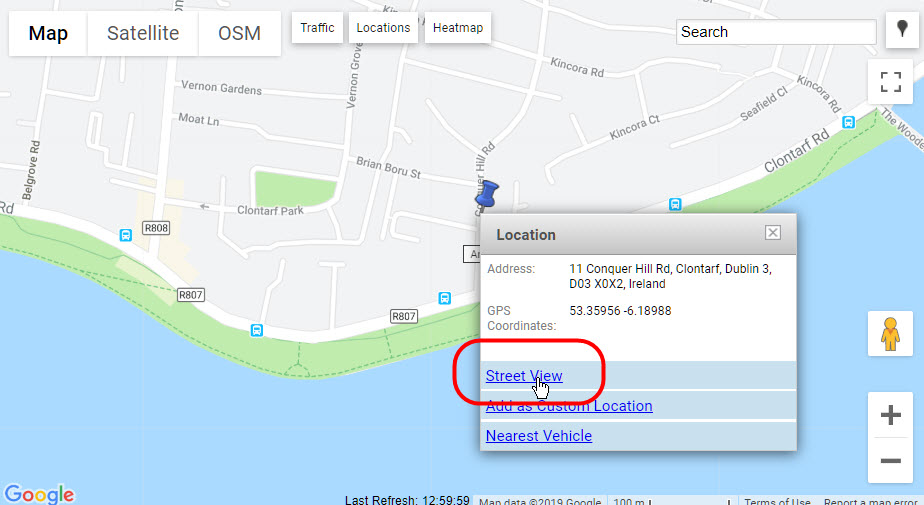
Right click on a road and select ‘Street View’ from the pop-up menu.
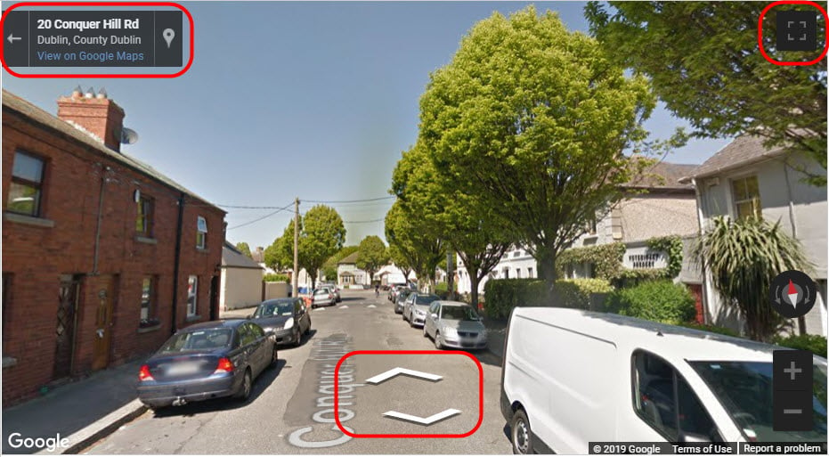
Once in Street View, you can:
- Pan the view by left clicking and dragging the view left or right.
- Follow the road by clicking on the arrow icons displayed on the road.
- Expand to full screen by clicking on the full screen icon in the top right-hand corner of the screen.
- Exit full screen by pressing the ESC key on your keyboard or clicking on the reduce screen icon in the right-hand corner of the screen.
- View directly in Google Maps by clicking on View in Google Maps in the top left-hand corner. Google Street Maps will open in a new browser tab so the map is still open in Transpoco Locate as you left it.
Click the left arrow in the left-hand corner of the screen to exit Street View and return to the Map view.